
"Free data for hydrological research and water resource planning"
|
Overview
HydroATLAS-Zambia provides a set of geospatial data layers ready to be used in any Geographic Information System software. The data layers contain a series of hydro-environmental sub-basin and river reach characteristics at high spatial resolution for the entire extent of Zambia. The attributes are organized in seven categories: hydrology; physiography; climate; land cover; soils; anthropogenic influences; and Zambia-specific ecological data. They include variables such as rainfall, runoff, discharge, species distributions, and many others. The goal of HydroATLAS-Zambia is to support a broad user community with a standardized and readily-available compendium of hydro-environmental attribute information for all catchments and rivers in Zambia. HydroATLAS-Zambia is a regionally customized version of the global HydroATLAS database. |
|
|
Technical documentation
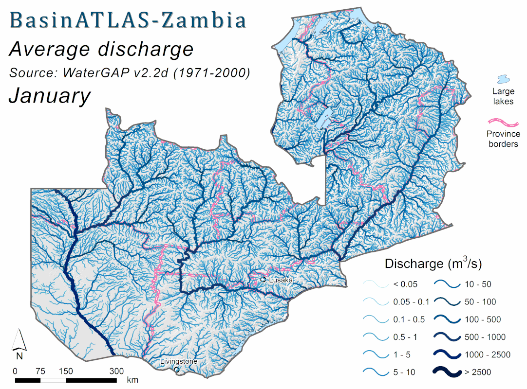
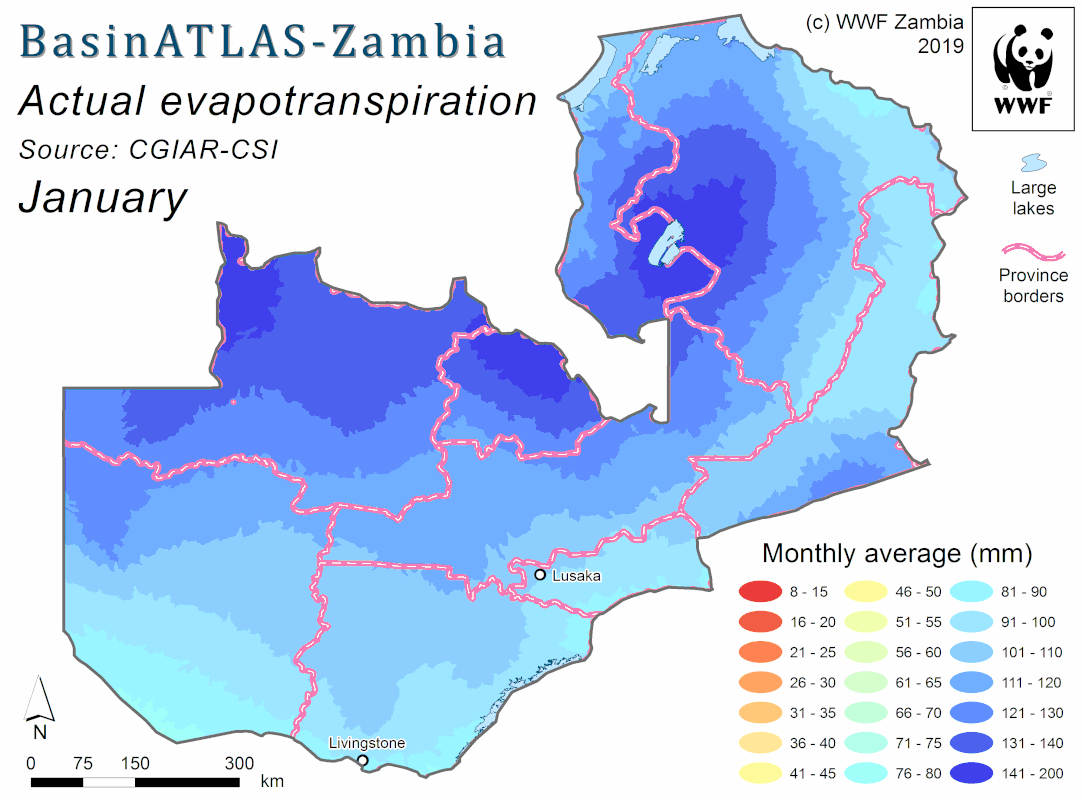
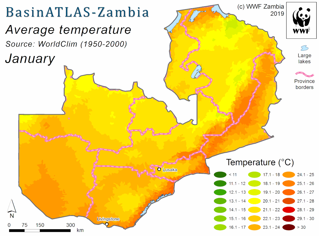
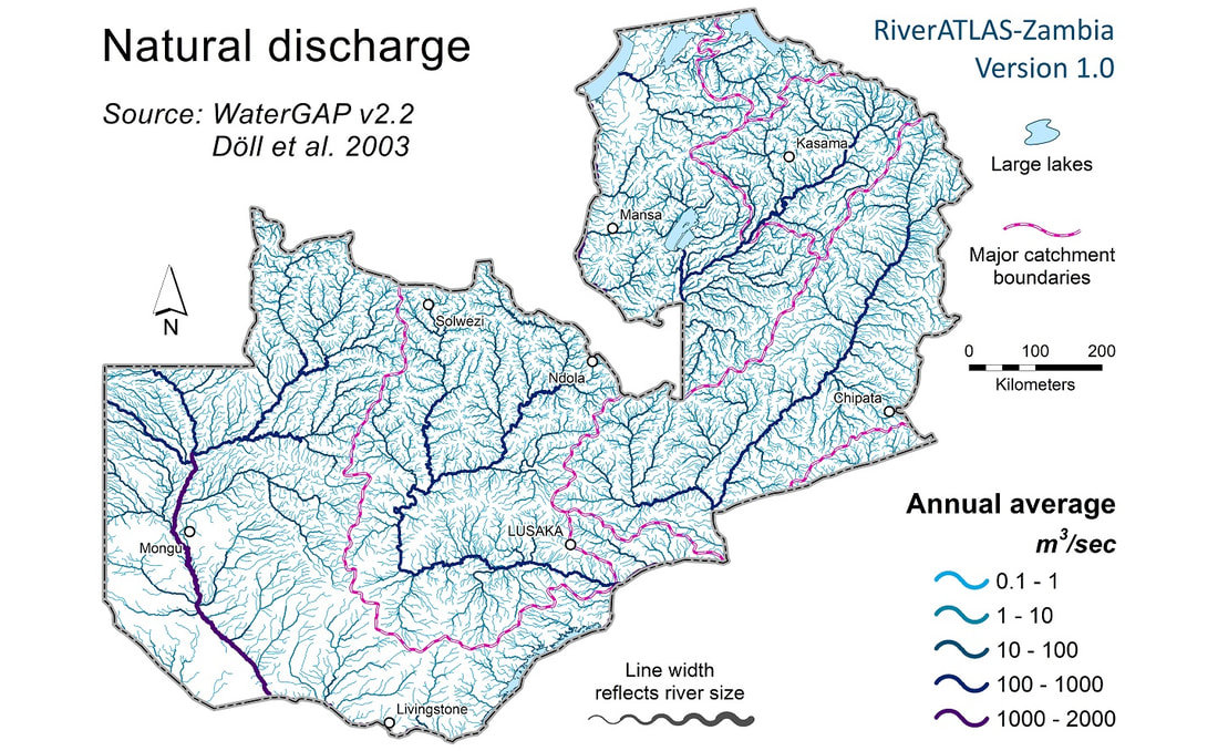
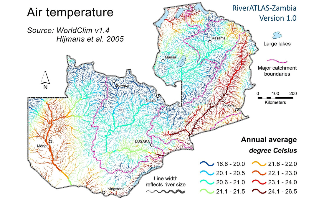
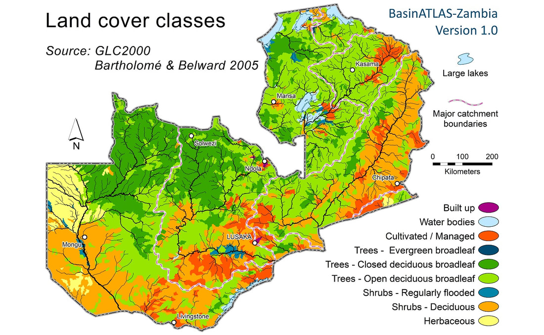
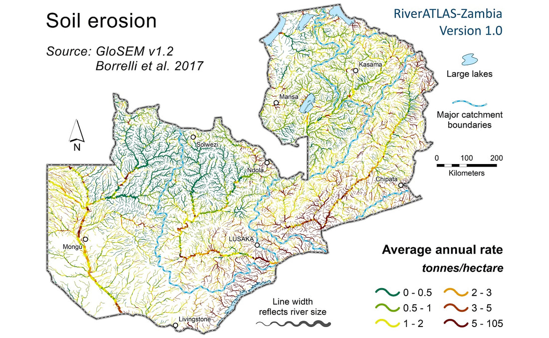
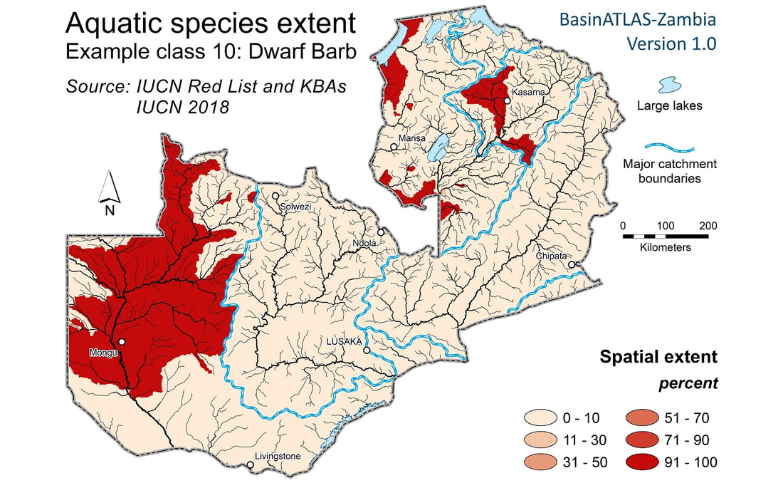
Version 1.0 of HydroATLAS-Zambia contains a total of 51 hydro-environmental variables which are broken down into 259 individual attributes (i.e., some variables are available as monthly layers, individual land cover classes or species distributions). Please consult the HydroATLAS-Zambia Technical Documentation for more details on the structure and content of the database. Please consult the BasinATLAS-Zambia Catalog (for sub-basins) or the RiverATLAS-Zambia Catalog (for river reaches) to get an overview of all available variables (note that these versions of the catalog only show low resolution maps; full resolution maps are provided when downloading the database). |
Hydro-environmental variables
Individual attributes
|
Support product HydroATLAS-Zambezi
HydroATLAS-Zambia is a customized version of the global HydroATLAS product and for simplicity, some data layers and features were removed. In particular, the breakdown of HydroATLAS into 12 spatial layers of hierarchically nested sub-basins is not available in HydroATLAS-Zambia (as this requires sub-basins to extend beyond the boundaries of Zambia). If you wish to work with the features (and data) of the global HydroATLAS product, you can use a regional copy, termed HydroATLAS-Zambezi, which covers the entire Zambezi Basin as well as parts of the upper Congo Basin which extend into Zambia.
HydroATLAS-Zambia is a customized version of the global HydroATLAS product and for simplicity, some data layers and features were removed. In particular, the breakdown of HydroATLAS into 12 spatial layers of hierarchically nested sub-basins is not available in HydroATLAS-Zambia (as this requires sub-basins to extend beyond the boundaries of Zambia). If you wish to work with the features (and data) of the global HydroATLAS product, you can use a regional copy, termed HydroATLAS-Zambezi, which covers the entire Zambezi Basin as well as parts of the upper Congo Basin which extend into Zambia.
HydroATLAS-Zambia and Water Resource Protection Areas (WRPAs)
HydroATLAS-Zambia data have been used to inform the Water Resource Protection Area (WRPA) assessment conducted by WARMA and WWF-Zambia in 2019. For more information and all data related to this project please visit the WRPA-Zambia website.
HydroATLAS-Zambia data have been used to inform the Water Resource Protection Area (WRPA) assessment conducted by WARMA and WWF-Zambia in 2019. For more information and all data related to this project please visit the WRPA-Zambia website.
Below are some animations showing example data from HydroATLAS-Zambia
< Click on images for full screen version >
< Click on images for full screen version >